
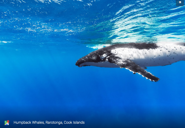
World Oceans Day is celebrated on 8 June, and this year Google is marking the occasion with some highlights of the underwater photography it’s collected as part of its Street View program. There’s brand new imagery for more than 40 locations around the world, including the Bahamas and the Great Barrier Reef, and you can see all of the locations through the Street View Oceans page.
The initiative is about more than sharing some impressive subaqueous photography, though – Google wants to draw attention to the preservation of these underwater kingdoms. “Mapping the ocean is key to preserving it,” write Jenifer Austin and Brian Sullivan of the Google Ocean Program. “Each image in Google Maps is a GPS-located digital record of these underwater and coastal environments, which can be used as a baseline to monitor change over time. This comprehensive record of coral reefs showcases the beauty of these ecosystems and highlights the threats they face.”